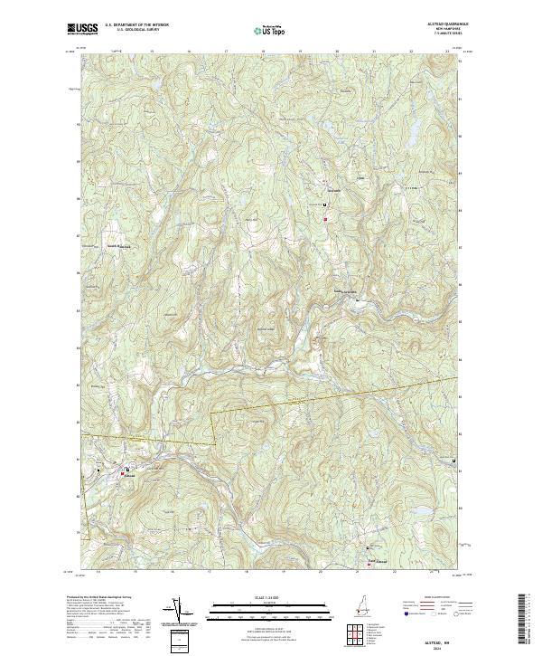
2024 Map of Alstead
USGS Topo · Published 2024About this map
Cold River winds through this section of Sullivan and Cheshire Counties, anchoring a landscape defined by small village centers and high topographic relief. The settlements of Alstead and South Acworth serve as local hubs, connected by a network of winding roads like Forest Rd and Acworth Rd that navigate the steep elevations of Beryl Mtn and Osgood Ledge. Genealogists will find several burial grounds documented, including Acworth Cem and Pine Grove Cem, which mark the historic community footprints near the river banks.
Find a feature on this map
105 named features on this map. Tap any name to fly to it.
Don’t see what you’re looking for? This feature index may not catch every label — zoom into the map to look around manually.
Map Details
Editions of this 2024 Alstead Map
This is the sole edition of this map. No revisions or reprints were ever made.
Other maps of this area

1902 · Sunapee
USGS Topo · 1:62,500

1905 · Sunapee
USGS Topo · 1:62,500

1907 · Sunapee
USGS Topo · 1:62,500

1926 · Claremont
USGS Topo · 1:62,500

1927 · Bellows Falls
USGS Topo · 1:48,000

1929 · Claremont
USGS Topo · 1:62,500

1930 · Lovewell Mountain
USGS Topo · 1:62,500

1930 · Bellows Falls
USGS Topo · 1:62,500

1942 · Lovewell Mountain
USGS Topo · 1:62,500

1950 · Glens Falls
USGS Topo · 1:250,000