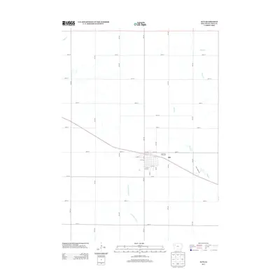
2013 Map of Alta
USGS Topo · Published 2013About this map
The town of Alta occupies the center of this agricultural landscape in Buena Vista County, Iowa. The street grid is detailed with residential and commercial corridors such as S Main St and Lake St, while the local civic presence is marked by the Buena Vista Fairgrounds on the town's eastern edge. A precise network of numbered section-line roads, including 540th St and 20th Ave, partitions the surrounding farmland into the classic Midwestern township and range pattern. Several watercourses drain the territory, notably the Little Maple River to the south and Brooke Cr to the northeast. The presence of Saint Andrews Dr and W Links Dr suggests modern residential developments and recreation areas extending from the traditional town center into the surrounding rural sections.
Find a feature on this map
35 named features on this map. Tap any name to fly to it.
Don’t see what you’re looking for? This feature index may not catch every label — zoom into the map to look around manually.
Map Details
Editions of this 2013 Alta Map
This is the sole edition of this map. No revisions or reprints were ever made.
Other maps of this area

1954 · Fort Dodge
USGS Topo · 1:250,000

1957 · Fort Dodge
USGS Topo · 1:250,000

1958 · Fort Dodge
USGS Topo · 1:250,000

1969 · Aurelia
USGS Topo · 1:24,000

1969 · Galva
USGS Topo · 1:24,000

1971 · Rembrandt
USGS Topo · 1:24,000

1971 · Peterson SW
USGS Topo · 1:24,000

1971 · Peterson SE
USGS Topo · 1:24,000

1979 · Lakeside
USGS Topo · 1:24,000

1979 · Storm Lake
USGS Topo · 1:24,000