
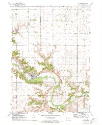
1971 Map of Rembrandt
USGS Topo · Published 1973About this map
Rembrandt serves as the central hub of this agricultural landscape in northwestern Iowa, situated along the line of the Chicago and North Western railroad. The map details the organized township structure of Buena Vista County, documenting the boundaries of Barnes, Deep, Scott, and Lincoln. Beyond the town grid, the terrain is defined by natural drainage features like Soldier Creek and Fox Run, which meander through the prairie sections. For those researching local heritage, the map identifies specific landmarks such as the Little Sioux Valley Cem and the Center Grove Ch in the southern portion of the quadrangle. This 1971 field-checked survey also captures municipal developments of the era, including the Sewage Disposal Ponds just south of the main settlement, providing a clear record of the area's mid-century infrastructure and land use.
Find a feature on this map
11 named features on this map. Tap any name to fly to it.
Don’t see what you’re looking for? This feature index may not catch every label — zoom into the map to look around manually.
Map Details
Editions of this 1971 Rembrandt Map
This is the sole edition of this map. No revisions or reprints were ever made.
Other maps of this area

1954 · Fort Dodge
USGS Topo · 1:250,000

1957 · Fort Dodge
USGS Topo · 1:250,000

1958 · Fort Dodge
USGS Topo · 1:250,000

1971 · Sioux Rapids SE
USGS Topo · 1:24,000

1971 · Sioux Rapids
USGS Topo · 1:24,000

1971 · Peterson SE
USGS Topo · 1:24,000
1971 · Peterson
USGS Topo · 1:24,000

1971 · Webb
USGS Topo · 1:24,000

1979 · Storm Lake
USGS Topo · 1:24,000

1979 · Alta
USGS Topo · 1:24,000