
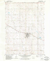
1979 Map of Alta
USGS Topo · Published 1979About this map
Alta serves as the central hub for this late-1970s landscape in Buena Vista County, where the grid-iron street pattern of the town meets the undulating agricultural terrain of Northwest Iowa. The Illinois Central Gulf railroad cuts a diagonal path through the township boundaries of Nokomis and Washington, dictating the orientation of the settlement and its early industrial footprint. Local history and genealogy are anchored by landmarks such as the Scandinavian Cem and Woodlawn Cem, which provide a record of the community's ancestral roots. Beyond the town center, the landscape is defined by the headwaters of the Maple River and the meandering courses of Brooke Creek and Powell Creek. Cultural and recreational spaces of the era are clearly marked, including the local Fairground and the Lake Creek Country Club, reflecting a period when small-town Iowa balanced its rail-dependent commerce with established social institutions.
Find a feature on this map
19 named features on this map. Tap any name to fly to it.
Don’t see what you’re looking for? This feature index may not catch every label — zoom into the map to look around manually.
Map Details
Editions of this 1979 Alta Map
2 editions found
Other maps of this area

1954 · Fort Dodge
USGS Topo · 1:250,000

1957 · Fort Dodge
USGS Topo · 1:250,000

1958 · Fort Dodge
USGS Topo · 1:250,000

1969 · Aurelia
USGS Topo · 1:24,000

1969 · Galva
USGS Topo · 1:24,000

1971 · Rembrandt
USGS Topo · 1:24,000

1971 · Peterson SW
USGS Topo · 1:24,000

1971 · Peterson SE
USGS Topo · 1:24,000

1979 · Lakeside
USGS Topo · 1:24,000

1979 · Storm Lake
USGS Topo · 1:24,000