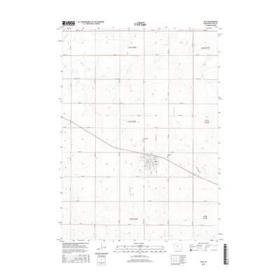
2015 Map of Alta
USGS Topo · Published 2015About this map
Alta stands as the central hub in this section of Buena Vista County, where a grid of rural roads connects the surrounding agricultural lands. The town's layout is defined by streets such as W 1st St and E 6th St, reflecting a well-organized local community. Two significant burial grounds, Scandinavian Cem and Woodlawn Cem, are situated near the town, providing valuable geographic markers for those researching the heritage of the area's early settlers. The landscape is naturally drained by several waterways, including the Little Maple River and Maple Cr, which flow through the undulating terrain. A dense network of section-line roads, including 530th St and Hwy M27, illustrates the enduring Public Land Survey System structure that has guided Iowa's land use for generations.
Find a feature on this map
33 named features on this map. Tap any name to fly to it.
Don’t see what you’re looking for? This feature index may not catch every label — zoom into the map to look around manually.
Map Details
Editions of this 2015 Alta Map
This is the sole edition of this map. No revisions or reprints were ever made.
Other maps of this area

1954 · Fort Dodge
USGS Topo · 1:250,000

1957 · Fort Dodge
USGS Topo · 1:250,000

1958 · Fort Dodge
USGS Topo · 1:250,000

1969 · Aurelia
USGS Topo · 1:24,000

1969 · Galva
USGS Topo · 1:24,000

1971 · Rembrandt
USGS Topo · 1:24,000

1971 · Peterson SW
USGS Topo · 1:24,000

1971 · Peterson SE
USGS Topo · 1:24,000

1979 · Lakeside
USGS Topo · 1:24,000

1979 · Storm Lake
USGS Topo · 1:24,000