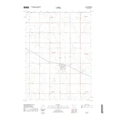
2018 Map of Alta
USGS Topo · Published 2018About this map
Alta sits as a primary hub within Buena Vista County, Iowa, at a point where the local watershed divides into several significant drainage systems. The town is surrounded by a grid of county roads and section lines, including Co Rd 66 and Co Hwy C43, which facilitate the region's agricultural transport. Water features define the periphery of the town, with the Little Maple River flowing to the south and Maple Creek appearing in the northwest corner, illustrating the undulating prairie drainage characteristic of this part of the state.
Find a feature on this map
31 named features on this map. Tap any name to fly to it.
Don’t see what you’re looking for? This feature index may not catch every label — zoom into the map to look around manually.
Map Details
Editions of this 2018 Alta Map
This is the sole edition of this map. No revisions or reprints were ever made.
Other maps of this area

1954 · Fort Dodge
USGS Topo · 1:250,000

1957 · Fort Dodge
USGS Topo · 1:250,000

1958 · Fort Dodge
USGS Topo · 1:250,000

1969 · Aurelia
USGS Topo · 1:24,000

1969 · Galva
USGS Topo · 1:24,000

1971 · Rembrandt
USGS Topo · 1:24,000

1971 · Peterson SW
USGS Topo · 1:24,000

1971 · Peterson SE
USGS Topo · 1:24,000

1979 · Lakeside
USGS Topo · 1:24,000

1979 · Storm Lake
USGS Topo · 1:24,000