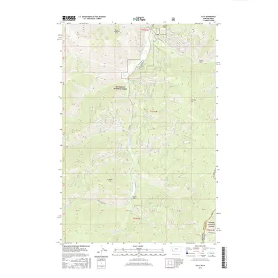
2017 Map of Alta
USGS Topo · Published 2017About this map
The settlement of Alta anchors this mountainous boundary region where the Bitterroot National Forest meets the Salmon National Forest. This 2017 study illustrates the intersection of Ravalli and Lemhi Counties, marking the rugged border between Montana and Idaho. The landscape is defined by the W Fork Bitterroot River and its numerous tributaries, including Chicken Cr and Hughes Cr, which carve through the high terrain.
Find a feature on this map
47 named features on this map. Tap any name to fly to it.
Don’t see what you’re looking for? This feature index may not catch every label — zoom into the map to look around manually.
Map Details
Editions of this 2017 Alta Map
This is the sole edition of this map. No revisions or reprints were ever made.
Other maps of this area

1956 · Elk City
USGS Topo · 1:250,000

1960 · Elk City
USGS Topo · 1:250,000

1960 · Painted Rocks Lake
USGS Topo · 1:62,500

1960 · Ulysses Mtn
USGS Topo · 1:62,500

1960 · Shoup
USGS Topo · 1:62,500

1960 · Piquett Mountain
USGS Topo · 1:62,500

1982 · Bighorn Crags
USGS Topo · 1:100,000
1991 · Piquett Mountain
USGS Topo · 1:24,000

1991 · Horse Creek Pass
USGS Topo · 1:24,000
1991 · Tincup Hill
USGS Topo · 1:24,000