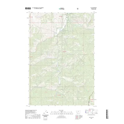
2023 Map of Alta
USGS Topo · Published 2023About this map
The settlement of Alta serves as a focal point within the northern reaches of the Bitterroot National Forest, situated where the West Fork Bitterroot River meets Hughes Creek. This high-country landscape is defined by its extensive network of drainage-based paths and ridgeline terrain, notably Than Wilkerson Ridge and the prominent Thunder Mtn. The map captures a topography shaped by water and elevation, with named features such as Stevens Gulch and Molloy Gulch cutting through the slopes.
Find a feature on this map
50 named features on this map. Tap any name to fly to it.
Don’t see what you’re looking for? This feature index may not catch every label — zoom into the map to look around manually.
Map Details
Editions of this 2023 Alta Map
This is the sole edition of this map. No revisions or reprints were ever made.
Other maps of this area

1956 · Elk City
USGS Topo · 1:250,000

1960 · Elk City
USGS Topo · 1:250,000

1960 · Painted Rocks Lake
USGS Topo · 1:62,500

1960 · Ulysses Mtn
USGS Topo · 1:62,500

1960 · Shoup
USGS Topo · 1:62,500

1960 · Piquett Mountain
USGS Topo · 1:62,500

1982 · Bighorn Crags
USGS Topo · 1:100,000
1991 · Piquett Mountain
USGS Topo · 1:24,000

1991 · Horse Creek Pass
USGS Topo · 1:24,000
1991 · Tincup Hill
USGS Topo · 1:24,000