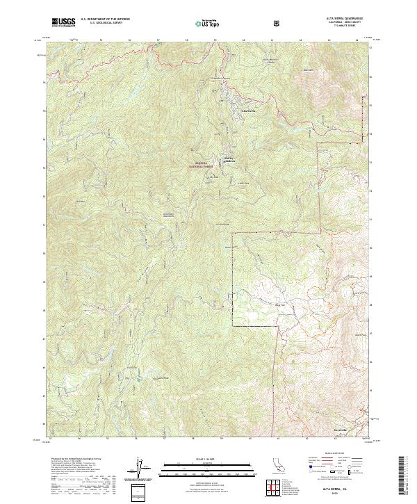
2022 Map of Alta Sierra
USGS Topo · Published 2022About this map
Alta Sierra stands as a focal point in this mountainous region of the Sequoia National Forest, where the transition from high peaks to lower gulches defines the local geography. The area is characterized by several distinct high-altitude settlements and recreational pockets including Shirley Meadows and Potato Patch. To the south, Keyesville occupies the lower terrain near Hoseye Gulch, contrasting with the northern summits.
Find a feature on this map
56 named features on this map. Tap any name to fly to it.
Don’t see what you’re looking for? This feature index may not catch every label — zoom into the map to look around manually.
Map Details
Editions of this 2022 Alta Sierra Map
This is the sole edition of this map. No revisions or reprints were ever made.
Other maps of this area

1906 · Kernville
USGS Topo · 1:125,000

1908 · Kernville
USGS Topo · 1:125,000

1920 · Delonagha
USGS Topo · 1:62,500

1926 · Glennville
USGS Topo · 1:62,500

1936 · Tobias Peak
USGS Topo · 1:125,000

1943 · Tobias Peak
USGS Topo · 1:125,000

1943 · Isabella
USGS Topo · 1:62,500

1945 · Tobias Peak
USGS Topo · 1:62,500

1948 · Bakersfield
USGS Topo · 1:250,000

1955 · Bakersfield
USGS Topo · 1:250,000