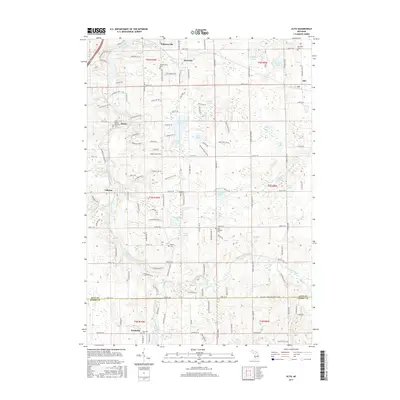
2017 Map of Alto
USGS Topo · Published 2017About this map
The Thornapple River and Coldwater River converge in this southeastern corner of Kent County, defining a landscape of glacial kettle lakes and historical river crossings. Several small communities, including Whitneyville, McCords, and Alaska, serve as focal points for local history, each often identified by its own community cemetery such as Whitneyville Cem or the Alaska Memorial Cem. The area’s geography is heavily shaped by water, with large bodies like Campau Lake and Morse Lake punctuating the rural township sections.
Find a feature on this map
130 named features on this map. Tap any name to fly to it.
Don’t see what you’re looking for? This feature index may not catch every label — zoom into the map to look around manually.
Map Details
Editions of this 2017 Alto Map
This is the sole edition of this map. No revisions or reprints were ever made.
Other maps of this area

1914 · Grand Rapids
USGS Topo · 1:62,500

1918 · Lowell
USGS Topo · 1:62,500

1943 · Grand Rapids
USGS Topo · 1:62,500

1943 · Lowell
USGS Topo · 1:62,500

1951 · Hastings
USGS Topo · 1:62,500

1958 · Grand Rapids
USGS Topo · 1:250,000

1959 · Wayland
USGS Topo · 1:62,500

1961 · Grand Rapids
USGS Topo · 1:250,000

1962 · Grand Rapids
USGS Topo · 1:250,000
1967 · Grand Rapids East
USGS Topo · 1:24,000
Featured Places
- Cascade Charter Township, MI
- Lowell Charter Township, MI
- Thornapple Township, MI
- McCords, Cascade Charter Township
- Alaska, MI