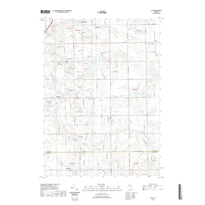
2019 Map of Alto
USGS Topo · Published 2019About this map
Whitneyville and McCords anchor the northern reaches of this township survey, which captures the rural character of the region as it transitioned into the twenty-first century. The landscape is defined by the winding course of the Thornapple River to the west and the Coldwater River to the south, with numerous glacial lakes like Campau Lake, Kettle Lake, and Morse Lake dotting the interior. A dense network of local cemeteries, including Whitneyville Cem, Alaska Memorial Cem, and Saint Patrick's Cem, offers significant research value for those tracking family lineage in the area.
Find a feature on this map
85 named features on this map. Tap any name to fly to it.
Don’t see what you’re looking for? This feature index may not catch every label — zoom into the map to look around manually.
Map Details
Editions of this 2019 Alto Map
This is the sole edition of this map. No revisions or reprints were ever made.
Other maps of this area

1914 · Grand Rapids
USGS Topo · 1:62,500

1918 · Lowell
USGS Topo · 1:62,500

1943 · Grand Rapids
USGS Topo · 1:62,500

1943 · Lowell
USGS Topo · 1:62,500

1951 · Hastings
USGS Topo · 1:62,500

1958 · Grand Rapids
USGS Topo · 1:250,000

1959 · Wayland
USGS Topo · 1:62,500

1961 · Grand Rapids
USGS Topo · 1:250,000

1962 · Grand Rapids
USGS Topo · 1:250,000
1967 · Grand Rapids East
USGS Topo · 1:24,000
Featured Places
- Cascade Charter Township, MI
- Lowell Charter Township, MI
- Thornapple Township, MI
- McCords, Cascade Charter Township
- Alaska, MI