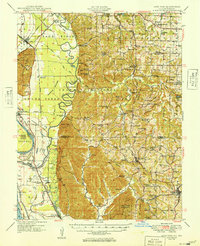
1949 Map of Alto Pass
USGS Topo · Published 1949About this map
Fountain Bluff stands as a prominent landmark above the Mississippi River floodplains in this late-1940s survey of southern Illinois. The landscape is defined by the sharp contrast between the flat river bottoms and the heavily dissected hills of the Shawnee National Forest. Along the river, historical transportation routes are well-preserved, including the site of Rattlesnake Ferry and Kings Ferry. The rail network is equally vital, with the Illinois Central Railroad and Missouri Pacific Railroad navigating the narrow corridor between the bluffs and the Big Muddy River.
Find a feature on this map
104 named features on this map. Tap any name to fly to it.
Don’t see what you’re looking for? This feature index may not catch every label — zoom into the map to look around manually.
Map Details
Editions of this 1949 Alto Pass Map
This is the sole edition of this map. No revisions or reprints were ever made.
Other maps of this area

1910 · Herrin
USGS Topo · 1:62,500

1910 · Murphysboro
USGS Topo · 1:62,500

1916 · Campbell Hill
USGS Topo · 1:62,500

1918 · Altenburg
USGS Topo · 1:62,500

1918 · Campbell Hill
USGS Topo · 1:62,500

1920 · Jonesboro
USGS Topo · 1:62,500

1920 · Dongola
USGS Topo · 1:62,500

1922 · Carbondale
USGS Topo · 1:62,500

1922 · Cape Girardeau
USGS Topo · 1:62,500

1923 · Dongola
USGS Topo · 1:62,500