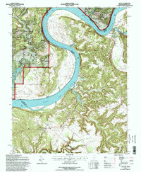
1993 Map of Alton
USGS Topo · Published 1998About this map
The Ohio River carves a massive, serpentine path through this borderland, separating Crawford and Perry Counties in Indiana from Meade and Breckinridge Counties in Kentucky. This late-century survey illustrates a landscape of high ridges and deep hollows, such as Boone Hollow and Dark Hollow, where small settlements are often tucked into the river's tightest bends. On the Kentucky side, St Theresa Academy and the village of Rhodelia stand atop the plateau, while Indiana's Magnet and Alton occupy the lower riverbanks. The map documents an intricate network of local history markers, including the Boyer Cross Roads and the Sacred Heart Ch. Along the river’s course, prominent navigational and topographic features like Bulls Point and Flint Island define the waterway’s character as it flows past Concordia and the mouths of Oil Creek and Mill Creek.
Find a feature on this map
59 named features on this map. Tap any name to fly to it.
Don’t see what you’re looking for? This feature index may not catch every label — zoom into the map to look around manually.
Map Details
Editions of this 1993 Alton Map
This is the sole edition of this map. No revisions or reprints were ever made.
Other maps of this area

1928 · Hardinsburg
USGS Topo · 1:48,000

1931 · Hardinsburg
USGS Topo · 1:62,500

1934 · Cannelton
USGS Topo · 1:62,500

1946 · Leavenworth
USGS Topo · 1:24,000

1947 · Irvington
USGS Topo · 1:24,000

1947 · Lodiburg
USGS Topo · 1:24,000

1947 · Leavenworth
USGS Topo · 1:24,000

1947 · Hardinsburg
USGS Topo · 1:62,500

1950 · Beechwood
USGS Topo · 1:24,000
1950 · Leavenworth
USGS Topo · 1:24,000