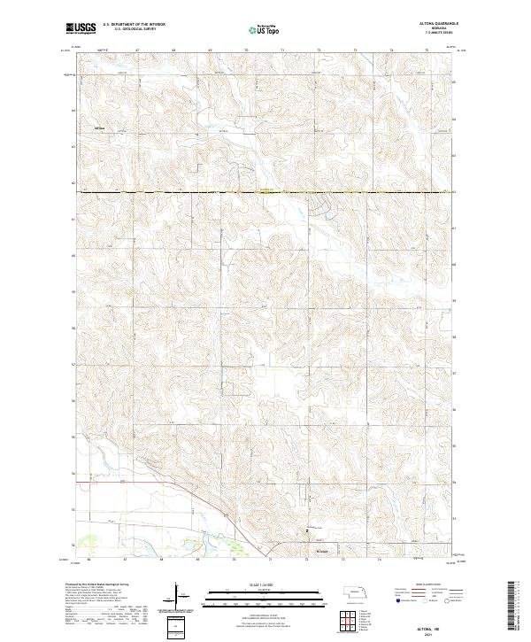
2021 Map of Altona
USGS Topo · Published 2021About this map
The Wayne and Cuming county line bisects this agricultural landscape in northeast Nebraska, revealing a pattern of section-line roads and creek-fed valleys. While Wisner occupies the southern edge of the survey, the smaller settlement of Altona sits near the northwestern corner, anchoring the local rural community. The terrain is defined by the winding course of Plum Creek and Sand Creek, which carve through the undulating hills of the t24n r4e and t25n r4e townships.
Find a feature on this map
21 named features on this map. Tap any name to fly to it.
Don’t see what you’re looking for? This feature index may not catch every label — zoom into the map to look around manually.
Map Details
Editions of this 2021 Altona Map
This is the sole edition of this map. No revisions or reprints were ever made.
Other maps of this area

1955 · Sioux City
USGS Topo · 1:250,000

1955 · Fremont
USGS Topo · 1:250,000

1957 · Fremont
USGS Topo · 1:250,000

1958 · Sioux City
USGS Topo · 1:250,000

1958 · Fremont
USGS Topo · 1:250,000

1959 · Sioux City
USGS Topo · 1:250,000

1963 · Pilger
USGS Topo · 1:24,000

1963 · Wisner
USGS Topo · 1:24,000

1963 · Altona
USGS Topo · 1:24,000
1963 · Stanton NE
USGS Topo · 1:24,000