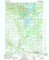
1985 Map of Altona
USGS Topo · Published 1985About this map
The Muskegon River meanders through the southwestern corner of this West Michigan landscape, anchoring a region defined by its dense network of glacial lakes and recreational waterways. The small settlement of Altona sits near the river's bend, flanked by Altona Riverside Park and a local Cem. To the east, the village of Sylvester is situated along Sylvester Creek, showing a classic rural settlement pattern typical of the mid-1980s.
Find a feature on this map
32 named features on this map. Tap any name to fly to it.
Don’t see what you’re looking for? This feature index may not catch every label — zoom into the map to look around manually.
Map Details
Editions of this 1985 Altona Map
This is the sole edition of this map. No revisions or reprints were ever made.
Other maps of this area

1954 · Midland
USGS Topo · 1:250,000

1958 · Midland
USGS Topo · 1:250,000

1958 · Big Rapids
USGS Topo · 1:62,500

1959 · Midland
USGS Topo · 1:250,000

1959 · Howard City
USGS Topo · 1:62,500

1964 · Six Lakes
USGS Topo · 1:24,000

1964 · Mecosta NW
USGS Topo · 1:24,000

1964 · Mecosta
USGS Topo · 1:24,000

1966 · Midland
USGS Topo · 1:250,000

1976 · Big Rapids SE
USGS Topo · 1:24,000