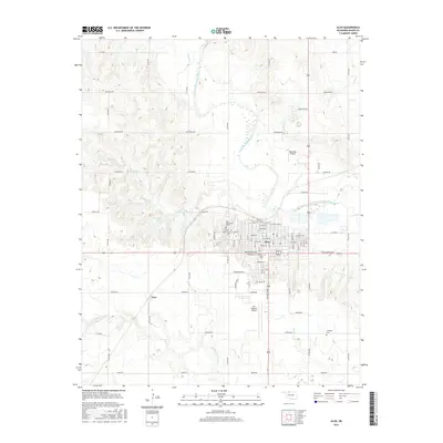
2016 Map of Alva
USGS Topo · Published 2016About this map
Alva serves as the prominent urban hub of Woods County, defined by a structured street grid that hosts Northwestern Oklahoma State Univ. The town's layout reflects a legacy of careful planning, with educational and religious institutions such as the Sacred Heart Cem and Alva Municipal Cem situated on the western periphery. The surrounding landscape is characterized by the winding path of the Salt Fork Arkansas River, which cuts through the prairie terrain alongside several smaller waterways like Turkey Cr and Boggy Cr. Transportation and commerce are centered around the local aviation facilities, including Alva Regional Airport and Woodlake Airport, while the smaller settlement of Noel and agricultural landmarks like Bouziden Lake illustrate the rural character of the outlying sections of the county.
Find a feature on this map
78 named features on this map. Tap any name to fly to it.
Don’t see what you’re looking for? This feature index may not catch every label — zoom into the map to look around manually.
Map Details
Editions of this 2016 Alva Map
This is the sole edition of this map. No revisions or reprints were ever made.
Other maps of this area

1955 · Woodward
USGS Topo · 1:250,000

1958 · Woodward
USGS Topo · 1:250,000

1968 · Capron
USGS Topo · 1:24,000

1969 · Dacoma
USGS Topo · 1:24,000

1969 · Tegarden NE
USGS Topo · 1:24,000

1969 · Tegarden SE
USGS Topo · 1:24,000

1969 · Alva SE
USGS Topo · 1:24,000

1969 · Hopeton
USGS Topo · 1:24,000

1969 · Avard
USGS Topo · 1:24,000

1969 · Alva NW
USGS Topo · 1:24,000