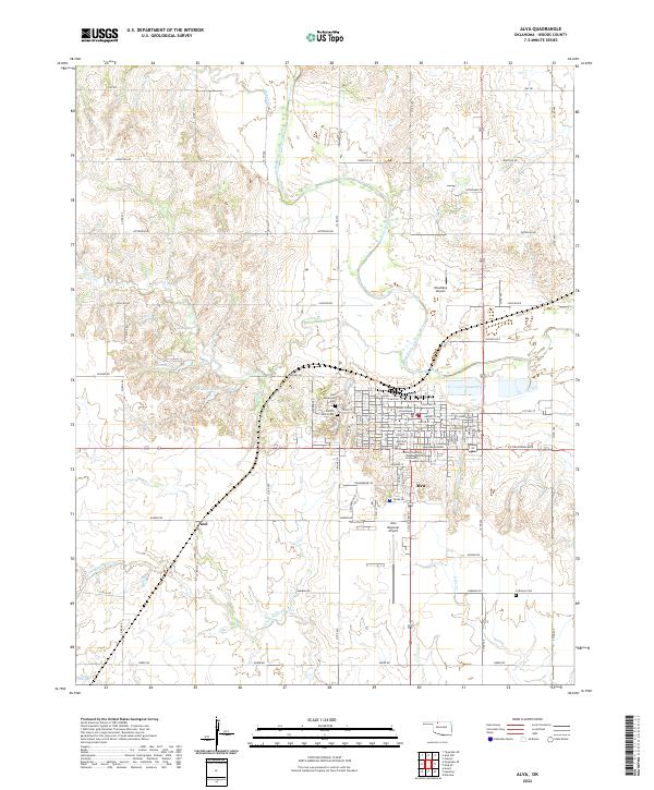
2022 Map of Alva
USGS Topo · Published 2022About this map
The city of Alva serves as the focal point of this Northwest Oklahoma survey, situated along the Salt Fork Arkansas River. The town's layout is centered around the Woods County Courthouse and the campus of Northwestern Oklahoma State University, which dominates the southern portion of the urban grid. Beyond the city limits, the landscape transitions into a network of section roads and watercourses like Turkey Cr and Little Eagle Chief Cr. Small settlements and landmarks such as Noel and several burial grounds, including the Alva Municipal Cem and Lutheran Cem, provide essential points of reference for genealogists tracing family roots in Woods County. The presence of Bouziden Lake and Discon Lake west of the city highlights the local water management and recreation patterns in this prairie environment.
Find a feature on this map
62 named features on this map. Tap any name to fly to it.
Don’t see what you’re looking for? This feature index may not catch every label — zoom into the map to look around manually.
Map Details
Editions of this 2022 Alva Map
This is the sole edition of this map. No revisions or reprints were ever made.
Other maps of this area

1955 · Woodward
USGS Topo · 1:250,000

1958 · Woodward
USGS Topo · 1:250,000

1968 · Capron
USGS Topo · 1:24,000

1969 · Dacoma
USGS Topo · 1:24,000

1969 · Tegarden NE
USGS Topo · 1:24,000

1969 · Tegarden SE
USGS Topo · 1:24,000

1969 · Alva SE
USGS Topo · 1:24,000

1969 · Hopeton
USGS Topo · 1:24,000

1969 · Avard
USGS Topo · 1:24,000

1969 · Alva NW
USGS Topo · 1:24,000