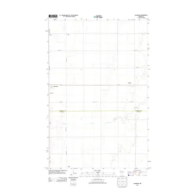
2013 Map of Alvarado
USGS Topo · Published 2013About this map
Alvarado sits at the intersection of MN-1 and MN-220 in the northwestern plains of Minnesota, where the township grid meets the meandering path of the Snake River. This 2013 survey captures the agricultural character of the region as it transitions between Marshall Co and Polk Co. The map is particularly useful for genealogists, as it documents several established burial grounds including Vega Cem, Oak Lawn Cem, and Nyskoga Cem, which anchor the surrounding rural sections. The small settlement of March appears further east along the highway, illustrating the sparse but deliberate distribution of communities across the flat river basin. The landscape is defined by its highly organized road network, featuring names like 440th Ave NW and 210th St NW, which facilitate the movement of goods through this productive farming corridor.
Find a feature on this map
14 named features on this map. Tap any name to fly to it.
Don’t see what you’re looking for? This feature index may not catch every label — zoom into the map to look around manually.
Map Details
Editions of this 2013 Alvarado Map
This is the sole edition of this map. No revisions or reprints were ever made.
Other maps of this area

1918 · Acton
USGS Topo · 1:62,500

1918 · Argyle
USGS Topo · 1:62,500

1918 · Warren
USGS Topo · 1:62,500

1952 · Thief River Falls
USGS Topo · 1:250,000

1954 · Stephen
USGS Topo · 1:62,500

1955 · Warren
USGS Topo · 1:62,500

1956 · Thief River Falls
USGS Topo · 1:250,000

1957 · Thief River Falls
USGS Topo · 1:250,000
1966 · Oslo NE
USGS Topo · 1:24,000
1966 · Big Woods
USGS Topo · 1:24,000