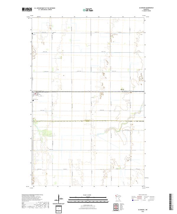
2022 Map of Alvarado
USGS Topo · Published 2022About this map
The Snake River winds through the heart of this Red River Valley landscape, marking the boundary where the flat agricultural plains of northwestern Minnesota meet the winding riparian corridor. Near the small settlement of March, the terrain is defined by a rigid section-line grid of rural roads such as 250th St NW and Co Hwy 69. This 2022 survey captures the persistent rural character of the area, where local history is anchored by the presence of Vega Cem in the northwest and Oak Lawn Cem further south. The map provides a clear look at the modern land divisions between the townships of t155n r49w and t154n r48w, illustrating how the drainage patterns of the Snake River have influenced the placement of homesteads and thoroughfares like Thompson St across the county line.
Find a feature on this map
19 named features on this map. Tap any name to fly to it.
Don’t see what you’re looking for? This feature index may not catch every label — zoom into the map to look around manually.
Map Details
Editions of this 2022 Alvarado Map
This is the sole edition of this map. No revisions or reprints were ever made.
Other maps of this area

1918 · Acton
USGS Topo · 1:62,500

1918 · Argyle
USGS Topo · 1:62,500

1918 · Warren
USGS Topo · 1:62,500

1952 · Thief River Falls
USGS Topo · 1:250,000

1954 · Stephen
USGS Topo · 1:62,500

1955 · Warren
USGS Topo · 1:62,500

1956 · Thief River Falls
USGS Topo · 1:250,000

1957 · Thief River Falls
USGS Topo · 1:250,000
1966 · Oslo NE
USGS Topo · 1:24,000
1966 · Big Woods
USGS Topo · 1:24,000