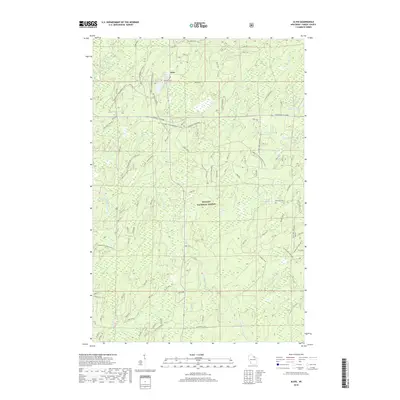
2018 Map of Alvin
USGS Topo · Published 2018About this map
Alvin sits at the northern edge of the Nicolet National Forest, a community defined by its proximity to the glacial lakes and spring-fed headwaters of Forest County. The landscape is dominated by the dense canopy and wetlands of the national forest, where the North Branch Pine River and Mypad Creek navigate the glacial terrain. Genealogy researchers can locate the Lakeview Cem situated just west of the town center near May Lake.
Find a feature on this map
104 named features on this map. Tap any name to fly to it.
Don’t see what you’re looking for? This feature index may not catch every label — zoom into the map to look around manually.
Map Details
Editions of this 2018 Alvin Map
This is the sole edition of this map. No revisions or reprints were ever made.
Other maps of this area

1898 · Iron River
USGS Topo · 1:62,500

1938 · Alvin
USGS Topo · 1:48,000

1939 · Long Lake
USGS Topo · 1:48,000

1944 · Iron River
USGS Topo · 1:24,000

1946 · Iron River
USGS Topo · 1:31,680

1946 · Alvin
USGS Topo · 1:48,000

1948 · Long Lake
USGS Topo · 1:48,000

1954 · Iron Mountain
USGS Topo · 1:250,000

1956 · Beechwood
USGS Topo · 1:62,500

1958 · Iron River
USGS Topo · 1:250,000