Old Maps of Argonne, Wisconsin
Explore 50 old maps of Argonne, spanning from 1938 to today. These high-resolution historic maps reveal how streets, neighborhoods, landmarks, and natural features evolved over time — perfect for genealogy, metal detecting, research, and local history exploration.
What you can do with these maps:
- See how Argonne changed over time: Compare historical maps to modern-day views to trace roads, homesites, rail lines & more.
- View detailed metadata: Each map includes creators, publishers, year, scale, and archive source.
- Overlay maps with satellite & LiDAR: Visualize the past alongside modern tools to explore terrain & human change.
- Trusted historical sources: Maps sourced from the USGS, Library of Congress, and other archives.
- Access maps your way: View online, download high-res files, or order prints for personal or research use.
Start exploring old maps of Argonne to uncover forgotten places, hidden landmarks, and the deep history beneath your feet.
Argonne, WI maps
(50)- 1938 Map of Alvin, 1956 Print
 1938 Alvin1956 Print · USGSForest and Vilas counties appear here in the late 1930s as centers of logging and new federal conservation efforts. You can trace the path of the Lumber RR, find remote Depression-era CCC Camp sites, and locate landmarks like the Jones Dam Fire Tower.2 unique versions available
 - 1939 Map of Crandon, 1955 Print
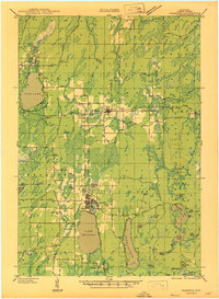
 1939 Crandon1955 Print · USGSForest County during the late 1930s was a critical junction of logging railroads and lakeside settlements. Genealogists and historians can trace rural school districts like Siding No 1 Sch and early infrastructure around Wisconsin Junction and Hiles Mill Pond.2 unique versions available
 - 1941 Map of Crandon
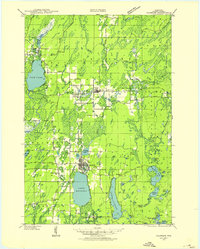
 1941 Crandon1941 Print · USGSForest County's timberlands and rail lines are mapped here in the years following the Great Depression. Genealogists can trace rural school locations like Kokoma Sch and the Argonne Cem, while following the old tracks of the St Paul and Sault Ste Marie railroad.
 - 1946 Map of Alvin
 1946 Alvin1946 Print · USGSNortheastern Wisconsin’s timberlands are shown here in the late 1930s as federal forestry and recreation infrastructure began to reshape the woods. Trace the locations of early CCC Camps, fire lookouts like the Jones Dam Fire Tower, and recreational sites such as Griswolds Camp on Butternut Lake.
 - 1947 Map of Crandon
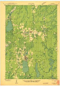
 1947 Crandon1947 Print · USGSForest County's timber and rail economy is on full display in the late 1940s, centered on the crossroads at Crandon. Genealogists can trace family roots through rural landmarks like the Argonne Cem and local schoolhouses including Sherman Sch and Kokoma Sch.
 - 1954 Map of Iron Mountain, 1964 Print
 1954 Iron Mountain1964 Print · USGSUpper Michigan and Northeastern Wisconsin are shown in detail during the mid-fifties, when the logging and mining economies still moved by rail. Trace the rail lines of the Soo Line to remote stops like Koepenick Station or explore the Iron Range near Iron Mountain.2 unique versions available
 - 1959 Map of Iron Mountain
 1959 Iron Mountain1959 Print · USGSThe northwoods of Wisconsin and the Michigan border are captured here in the mid-fifties, showing a landscape defined by timber, water, and rail. Researchers can trace historic junctions like Hiles Junction, the expansive Nicolet National Forest, and lakefront settlements from Rhinelander to Tomahawk.2 unique versions available
 - 1965 Map of Argonne, 1966 Print
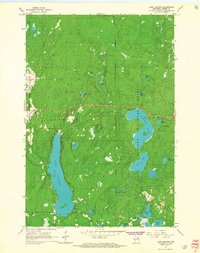
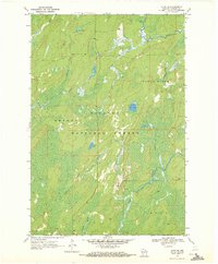
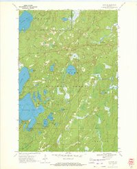
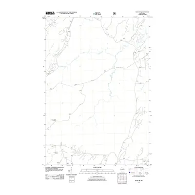
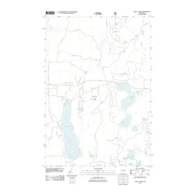
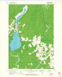 1965 Argonne1966 Print · USGSForest County's timber and rail history is on full display here in the mid-sixties, centered on the communities of Argonne and Hiles. Genealogists and historians can locate St Marys Cem, the old Soo Line rail corridors, and the Hiles Lookout Tower overlooking the Nicolet National Forest.2 unique versions available
 - 1965 Map of Lake Lucerne, 1967 Print
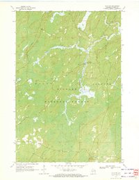
 1965 Lake Lucerne1967 Print · USGSForest County's dense northern woodlands are captured here during the mid-sixties, showing the rugged lake-and-hill country of the Nicolet National Forest. You can locate landmarks like the Lookout Tower on Sugarbush Hill and the remote Boy Scout Camp on the shores of Hardwood Lake.2 unique versions available
 - 1965 Map of Crandon NE, 1992 Print
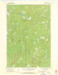
 1965 Crandon NE1992 Print · USGSForest County in the mid-1960s was a landscape where the Northwoods timber industry met the rails. Trace the path of the Soo Line as it connects the settlements of Argonne and Middle, or follow the winding courses of the Peshtigo River and Popple River.
 - 1970 Map of Alvin, 1972 Print
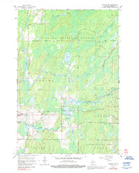
 1970 Alvin1972 Print · USGSForest County in the early seventies shows a remote logging and recreation landscape centered on the settlement of Alvin. Researchers can trace old family landmarks and local infrastructure like Lakeview Cem, the Pine River Lookout Tower, and Windsor Dam Campground.3 unique versions available
 - 1970 Map of Alvin SW, 1972 Print
 1970 Alvin SW1972 Print · USGSForest County, Wisconsin, is captured here in the early 1970s within the vast boundaries of the Nicolet National Forest. You can trace old logging routes along the Railroad Grade or locate fishing spots near the Pine River Campground and Peshtigo River.2 unique versions available
 - 1970 Map of Alvin SE, 1972 Print
 1970 Alvin SE1972 Print · USGSForest County, Wisconsin, is depicted here in the early seventies as a dense patchwork of federal timberlands and glacial waterways. Researchers can trace the winding paths of the Pine River and Popple River or locate remote landmarks like Rat Lake.3 unique versions available
 - 1970 Map of Alvin NW, 1972 Print
 1970 Alvin NW1972 Print · USGSForest County's wilderness is documented here in the early 1970s, showcasing a landscape defined by the Nicolet National Forest. You can trace old shoreline features and forest access points near Butternut Lake, Franklin Lake, and the Luna-White Deer Campground.2 unique versions available
 - 1991 Map of Iron Mountain
 1991 Iron Mountain1991 Print · USGSThe Michigan-Wisconsin borderlands appear here in the early nineties, centered on the industrial corridor along the Menominee River. Local researchers can trace the Soo Line through remote timber settlements or locate mining sites like the Bradley Mine and Trader Mine.
 - 2011 Map of Alvin SE, 2011 Print
 2011 Alvin SE2011 Print · USGSCovers Argonne, including Popple River, Ross, and other nearby areas
 - 2011 Map of Alvin NW, 2011 Print
 2011 Alvin NW2011 Print · USGSCovers Argonne, including Phelps, Hiles, and other nearby areas
 - 2011 Map of Argonne, 2011 Print
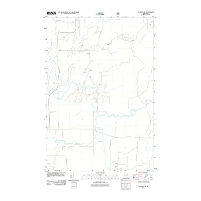
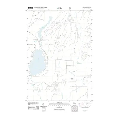 2011 Argonne2011 Print · USGSCovers Argonne, including Hiles, Lincoln, and other nearby areas
 - 2011 Map of Alvin SW, 2011 Print
 2011 Alvin SW2011 Print · USGSCovers Argonne, including Hiles, Forest County, and other nearby areas
 - 2011 Map of Crandon NE, 2011 Print
 2011 Crandon NE2011 Print · USGSCovers Argonne, including Laona, Ross, and other nearby areas
 - 2011 Map of Alvin, 2011 Print
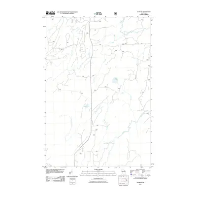
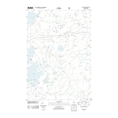
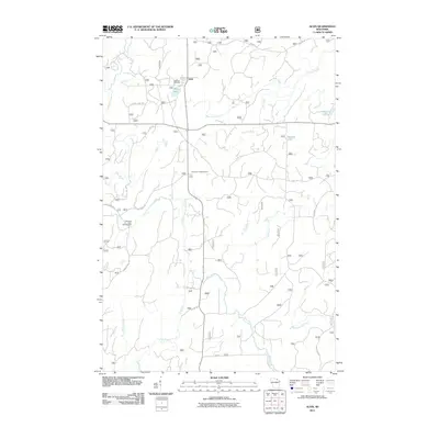 2011 Alvin2011 Print · USGSCovers Argonne, including Alvin, Popple River, and other nearby areas
 - 2011 Map of Lake Lucerne, 2011 Print
 2011 Lake Lucerne2011 Print · USGSCovers Argonne, including Crandon, Laona, and other nearby areas
 - 2013 Map of Alvin SE, 2013 Print
 2013 Alvin SE2013 Print · USGSCovers Argonne, including Popple River, Ross, and other nearby areas
 - 2013 Map of Argonne, 2013 Print
 2013 Argonne2013 Print · USGSCovers Argonne, including Hiles, Lincoln, and other nearby areas
 - 2013 Map of Alvin SW, 2013 Print
 2013 Alvin SW2013 Print · USGSCovers Argonne, including Hiles, Forest County, and other nearby areas
Showing maps 1-25 of 50
Top cities near Argonne
- Three Lakes historical maps
- Crandon historical maps
- Washington historical maps
- Phelps historical maps
- Laona historical maps
- Nashville historical maps
See more
Frequently asked questions
- What are the different types of historical maps available for Argonne?
- What is the oldest map of Argonne?
- Where can I purchase historical maps of Argonne for my home or office?
- Where can I download high-res historical maps of Argonne?
- Are there historical topographic maps available for Argonne?
- Is there historical aerial imagery available for Argonne?
- Where are historical maps of Argonne sourced from?