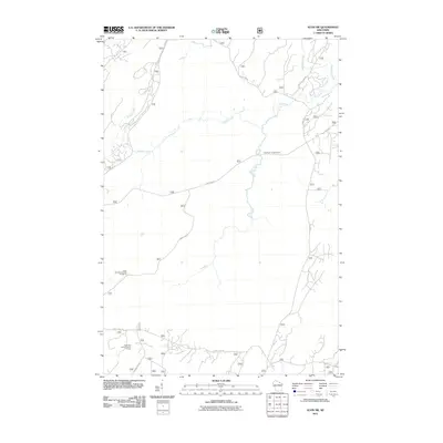
2011 Map of Alvin SW
USGS Topo · Published 2011About this map
Pine River and its major tributaries, Kimball Creek and McDonald Creek, define the drainage patterns of this northern Wisconsin forestland. At the turn of the 21st century, the area remains a dedicated recreational landscape, highlighted by the Pine River Campground and the Giant Pine Grove Point of Interest. A network of forest service roads, including Experimental Rd and Divide Rd, provides access to these timberlands and leisure sites. The naming of roads like Jones Dam Rd and Windsor Dam Rd points to the historical legacy of water management and logging along the regional waterways. The Giant Pine Ski and Hike Parking Lot serves as a primary access point for exploring the quiet, undeveloped expanses of the Argonne area.
Find a feature on this map
13 named features on this map. Tap any name to fly to it.
Don’t see what you’re looking for? This feature index may not catch every label — zoom into the map to look around manually.
Map Details
Editions of this 2011 Alvin SW Map
This is the sole edition of this map. No revisions or reprints were ever made.
Other maps of this area

1928 · Three Lakes
USGS Topo · 1:48,000

1938 · Alvin
USGS Topo · 1:48,000

1938 · Three Lakes
USGS Topo · 1:48,000

1939 · Crandon
USGS Topo · 1:48,000

1940 · Monico
USGS Topo · 1:48,000

1941 · Crandon
USGS Topo · 1:48,000

1945 · Three Lakes
USGS Topo · 1:48,000

1946 · Alvin
USGS Topo · 1:48,000

1947 · Crandon
USGS Topo · 1:48,000

1950 · Monico
USGS Topo · 1:48,000