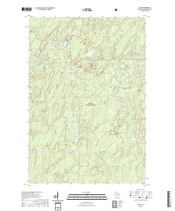
2022 Map of Alvin
USGS Topo · Published 2022About this map
Alvin sits at the heart of this Northwoods landscape, where the Nicolet National Forest covers much of the terrain. The settlement is anchored by the Lakeview Cem and the waters of May Lake, serving as a central point for a network of forest roads and trails. The geography is defined by an extensive system of springs and lakes, including Charlie Otto Spring, Killborn Lake, and Onimish Lake. Transport and recreation are intertwined here, with the Wisconsin 70 Trunk highway and the Forest Co Snowmobile Trl providing access through the dense woodland. The southern portion of the map is dominated by the winding path of the Pine River, along with its various branches and tributaries like North Branch Pine River and Wildcat Cr, illustrating the complex hydrology that supported the local timber and recreation economies.
Find a feature on this map
40 named features on this map. Tap any name to fly to it.
Don’t see what you’re looking for? This feature index may not catch every label — zoom into the map to look around manually.
Map Details
Editions of this 2022 Alvin Map
This is the sole edition of this map. No revisions or reprints were ever made.
Other maps of this area

1898 · Iron River
USGS Topo · 1:62,500

1938 · Alvin
USGS Topo · 1:48,000

1939 · Long Lake
USGS Topo · 1:48,000

1944 · Iron River
USGS Topo · 1:24,000

1946 · Iron River
USGS Topo · 1:31,680

1946 · Alvin
USGS Topo · 1:48,000

1948 · Long Lake
USGS Topo · 1:48,000

1954 · Iron Mountain
USGS Topo · 1:250,000

1956 · Beechwood
USGS Topo · 1:62,500

1958 · Iron River
USGS Topo · 1:250,000