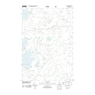
2011 Map of Alvin NW
USGS Topo · Published 2011About this map
Kentuck Lake and Franklin Lake anchor a landscape defined by an extensive network of freshwater lakes and forest service corridors in this northern Wisconsin survey. The area is characterized by seasonal recreational settlements and established campsites, including Kentuck Lake Campground, Griswolds Camp, and Camp White Deer. The drainage pattern is complex, with the North Branch Pine River and Brule Creek winding through the timberland.
Find a feature on this map
40 named features on this map. Tap any name to fly to it.
Don’t see what you’re looking for? This feature index may not catch every label — zoom into the map to look around manually.
Map Details
Editions of this 2011 Alvin NW Map
This is the sole edition of this map. No revisions or reprints were ever made.
Other maps of this area

1928 · Three Lakes
USGS Topo · 1:48,000

1938 · Phelps
USGS Topo · 1:48,000

1938 · Alvin
USGS Topo · 1:48,000

1938 · Three Lakes
USGS Topo · 1:48,000

1945 · Three Lakes
USGS Topo · 1:48,000

1946 · Alvin
USGS Topo · 1:48,000

1950 · Phelps
USGS Topo · 1:48,000

1954 · Iron Mountain
USGS Topo · 1:250,000

1956 · Beechwood
USGS Topo · 1:62,500

1956 · Phelps
USGS Topo · 1:62,500