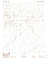
1986 Map of Alvord Mountain East
USGS Topo · Published 1986About this map
Alvord Mountain dominates this arid landscape in San Bernardino County, where dramatic elevation changes are defined by features like Alvord Peak and the winding Spanish Canyon. By the mid-1980s, this area served as a critical corridor for infrastructure and national defense, bisected by the Fort Irwin Military Reservation Boundary. The map reveals a high-desert environment utilized for communication and power, evidenced by several Transmission Lines and the Radio Facility (Host Sandy) perched on the higher ground. A network of 4wd trails provides the only access through the rugged terrain of Clews Ridge, indicating the isolation and challenging topography of this Mojave Desert region during the late twentieth century.
Find a feature on this map
10 named features on this map. Tap any name to fly to it.
Don’t see what you’re looking for? This feature index may not catch every label — zoom into the map to look around manually.
Map Details
Editions of this 1986 Alvord Mountain East Map
2 editions found
Other maps of this area

1933 · Avawatz Mountains
USGS Topo · 1:250,000

1947 · Trona
USGS Topo · 1:250,000

1948 · Trona
USGS Topo · 1:250,000

1948 · Alvord Mountain
USGS Topo · 1:62,500

1948 · Cave Mountain
USGS Topo · 1:62,500

1951 · Cave Mountain
USGS Topo · 1:62,500

1951 · Alvord Mountain
USGS Topo · 1:62,500

1953 · San Bernardino
USGS Topo · 1:250,000

1953 · Trona
USGS Topo · 1:250,000

1955 · Newberry
USGS Topo · 1:62,500