
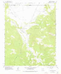
1963 Map of Amalia
USGS Topo · Published 1967About this map
Amalia and the smaller settlement of Ventero occupy a high-elevation valley during the early 1960s, framed by the massive landforms of the San Pedro Mesa and the Sangre De Cristo range. The local community is centered around the Santo Niño Ch and the Amalia Sch, illustrating a traditional New Mexican mountain village structure where life followed the courses of Costilla Creek and its many tributaries like Jarocito Creek and Ute Creek. The topography is crisscrossed by a network of unimproved roads and a Pack Trail, reflecting the livestock and resource-based economy of the Sangre de Cristo foothills. Evidence of local industry appears in several labeled Mine sites near Ballejos Creek, while a Gaging Sta downstream suggests the importance of water management in this arid but alpine environment.
Find a feature on this map
19 named features on this map. Tap any name to fly to it.
Don’t see what you’re looking for? This feature index may not catch every label — zoom into the map to look around manually.
Map Details
Editions of this 1963 Amalia Map
2 editions found
Other maps of this area

1954 · Raton
USGS Topo · 1:250,000

1954 · Trinidad
USGS Topo · 1:250,000

1955 · Trinidad
USGS Topo · 1:250,000

1958 · Raton
USGS Topo · 1:250,000

1958 · Trinidad
USGS Topo · 1:250,000

1959 · Trinidad
USGS Topo · 1:250,000

1963 · Costilla
USGS Topo · 1:24,000

1963 · Cerro
USGS Topo · 1:24,000

1963 · Latir Peak
USGS Topo · 1:24,000

1963 · Comanche Point
USGS Topo · 1:24,000