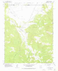
1963 Map of Amalia
USGS Topo · Published 1975About this map
Sangre De Cristo Grant lands dominate this high-altitude landscape along the border of Colorado and New Mexico in the early 1960s. The settlement of Amalia is the primary focal point, situated at the junction of several drainage systems where the Amalia Sch and Santo Niño Ch served the local community. The map illustrates a transitional environment where the flat expanse of San Pedro Mesa gives way to a network of steep canyons and watercourses, including Costilla Creek and Ute Creek.
Find a feature on this map
20 named features on this map. Tap any name to fly to it.
Don’t see what you’re looking for? This feature index may not catch every label — zoom into the map to look around manually.
Map Details
Editions of this 1963 Amalia Map
2 editions found
Other maps of this area

1954 · Raton
USGS Topo · 1:250,000

1954 · Trinidad
USGS Topo · 1:250,000

1955 · Trinidad
USGS Topo · 1:250,000

1958 · Raton
USGS Topo · 1:250,000

1958 · Trinidad
USGS Topo · 1:250,000

1959 · Trinidad
USGS Topo · 1:250,000

1963 · Costilla
USGS Topo · 1:24,000

1963 · Amalia
USGS Topo · 1:24,000

1963 · Cerro
USGS Topo · 1:24,000

1963 · Latir Peak
USGS Topo · 1:24,000