
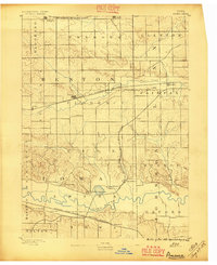
1889 Map of Amana
USGS Topo · Published 1889About this map
The Amana colonies and their distinct communal settlement pattern dominate the southern portion of this 1888 survey, clustered near the winding Iowa River. Each village, from West Amana and Hohe Amana to East Amana, is clearly defined during a period of peak cultural isolation and agricultural self-sufficiency. This landscape is a patchwork of communal labor and transportation connectivity, where three major rail lines bisect the prairie to serve these burgeoning agricultural centers.
Find a feature on this map
33 named features on this map. Tap any name to fly to it.
Don’t see what you’re looking for? This feature index may not catch every label — zoom into the map to look around manually.
Map Details
Editions of this 1889 Amana Map
2 editions found
Other maps of this area

1887 · Cedar Rapids
USGS Topo · 1:62,500

1888 · Shellsburg
USGS Topo · 1:62,500

1888 · Marion
USGS Topo · 1:62,500

1888 · Amana
USGS Topo · 1:62,500

1889 · Marion
USGS Topo · 1:62,500

1889 · Shellsburg
USGS Topo · 1:62,500

1891 · Oxford
USGS Topo · 1:62,500

1891 · Cedar Rapids
USGS Topo · 1:62,500

1891 · Iowa City
USGS Topo · 1:62,500

1894 · Oxford
USGS Topo · 1:62,500