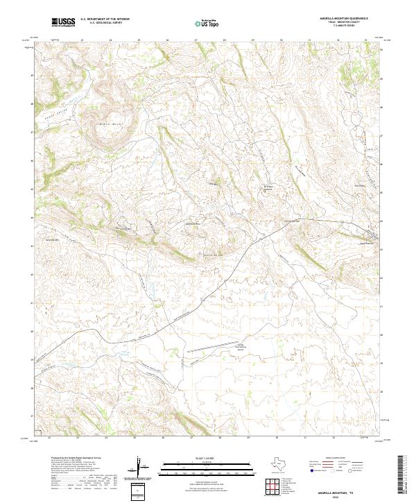
2022 Map of Amarilla Mountain
USGS Topo · Published 2022About this map
Amarilla Mtn and Black Mesa anchor this landscape in Brewster County, where the high desert terrain is marked by steep canyons and limestone plateaus. The map details a network of ranch roads and specialized routes like Lone Star Ranch Rd and the Sawmill Cutoff Rd, which thread through the drainage basins of Contrabando Cr and Comanche Cr. Notable geological and industrial sites are documented, including the Terlingua Sinkhole and the N Lone Star Mine, reflecting the region's mining history.
Find a feature on this map
34 named features on this map. Tap any name to fly to it.
Don’t see what you’re looking for? This feature index may not catch every label — zoom into the map to look around manually.
Map Details
Editions of this 2022 Amarilla Mountain Map
This is the sole edition of this map. No revisions or reprints were ever made.
Other maps of this area

1903 · Terlingua
USGS Topo · 1:125,000

1904 · Terlingua
USGS Topo · 1:125,000

1931 · Lajitas
USGS Topo · 1:62,500

1959 · Emory Peak
USGS Topo · 1:250,000

1965 · Emory Peak
USGS Topo · 1:250,000

1971 · Yellow Hill
USGS Topo · 1:24,000

1971 · Terlingua
USGS Topo · 1:24,000

1971 · Amarilla Mountain
USGS Topo · 1:24,000
1971 · The Solitario
USGS Topo · 1:24,000
1971 · Hen Egg Mountain
USGS Topo · 1:24,000