
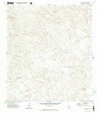
1971 Map of Yellow Hill
USGS Topo · Published 1973About this map
Yellow Hill and Pinks Peak define the high elevations of this Brewster County landscape, surveyed in the early 1970s. This arid terrain is defined by complex drainage patterns, with the significant Terlingua Creek flowing along the eastern edge and the winding Saltgrass Draw cutting through the central portion of the quadrangle. The presence of a Spring near Black Ridge suggests the critical importance of water sources in this dry environment.
Find a feature on this map
9 named features on this map. Tap any name to fly to it.
Don’t see what you’re looking for? This feature index may not catch every label — zoom into the map to look around manually.
Map Details
Editions of this 1971 Yellow Hill Map
2 editions found
Other maps of this area

1903 · Terlingua
USGS Topo · 1:125,000

1904 · Terlingua
USGS Topo · 1:125,000

1917 · Agua Fria
USGS Topo · 1:62,500

1917 · Tascotal Mesa
USGS Topo · 1:62,500

1931 · Lajitas
USGS Topo · 1:62,500

1937 · Agua Fria
USGS Topo · 1:62,500

1944 · Tascotal Mesa
USGS Topo · 1:62,500

1959 · Emory Peak
USGS Topo · 1:250,000

1965 · Emory Peak
USGS Topo · 1:250,000

1971 · Terlingua
USGS Topo · 1:24,000