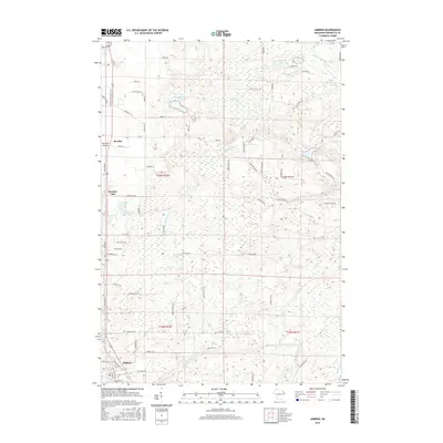
2016 Map of Amberg
USGS Topo · Published 2016About this map
The Pike River winds through the southern landscape of this Marinette County region, where the town of Amberg sits alongside the Amberg Cem. Further north, the settlement of Beecher and nearby Beecher Lake define a terrain heavily shaped by glacial water bodies and meandering creeks. The map reveals a dense network of forest and quarry roads, including Mundt Quarry Rd and State Quarry Ln, indicating the local importance of stone extraction and timber management. Scattered wetlands surround features like Headquarters Lake and the Miscauno Pond, while the presence of the Red Roof Airport provides a modern navigational landmark amidst the rural township lines of t36n r20e and t35n r21e. This 2016 survey captures the area's mix of natural conservation and working-land infrastructure, from the small named lakes like Mullaney Lake to the various branches of Miscauno Cr.
Find a feature on this map
76 named features on this map. Tap any name to fly to it.
Don’t see what you’re looking for? This feature index may not catch every label — zoom into the map to look around manually.
Map Details
Editions of this 2016 Amberg Map
This is the sole edition of this map. No revisions or reprints were ever made.
Other maps of this area

1939 · Pembine
USGS Topo · 1:48,000

1939 · Dunbar
USGS Topo · 1:48,000

1940 · Athelstane
USGS Topo · 1:48,000

1941 · Dunbar
USGS Topo · 1:48,000

1942 · Athelstane
USGS Topo · 1:48,000

1942 · Wausaukee
USGS Topo · 1:48,000

1947 · Pembine
USGS Topo · 1:48,000

1947 · Dunbar
USGS Topo · 1:48,000

1947 · Wausaukee
USGS Topo · 1:48,000

1954 · Iron Mountain
USGS Topo · 1:250,000