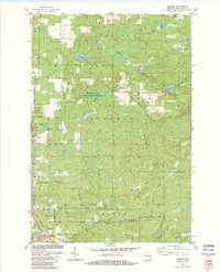
1982 Map of Amberg
USGS Topo · Published 1983About this map
Granite quarrying and public conservation lands define this portion of Marinette County during the early 1980s. The settlement of Amberg sits near the southern edge, where the Pike River and its various tributaries, including Slough Creek, wind through a landscape dotted with numerous quarries and gravel pits. To the north, the Miscauno State Public Hunting Grounds preserves a significant wetland corridor around the South Branch and North Branch Miscauno Creek.
Find a feature on this map
51 named features on this map. Tap any name to fly to it.
Don’t see what you’re looking for? This feature index may not catch every label — zoom into the map to look around manually.
Map Details
Editions of this 1982 Amberg Map
This is the sole edition of this map. No revisions or reprints were ever made.
Other maps of this area

1939 · Pembine
USGS Topo · 1:48,000

1939 · Dunbar
USGS Topo · 1:48,000

1940 · Athelstane
USGS Topo · 1:48,000

1941 · Dunbar
USGS Topo · 1:48,000

1942 · Athelstane
USGS Topo · 1:48,000

1942 · Wausaukee
USGS Topo · 1:48,000

1947 · Pembine
USGS Topo · 1:48,000

1947 · Dunbar
USGS Topo · 1:48,000

1947 · Wausaukee
USGS Topo · 1:48,000

1954 · Iron Mountain
USGS Topo · 1:250,000