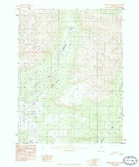
1985 Map of Ambler River A-1
USGS Topo · Published 1985About this map
The Kogoluktuk River snakes through the center of this remote Alaskan interior, meeting the Ambler River amidst a landscape of riverine lowlands and significant mountain peaks. Recorded in the mid-1980s, the terrain is characterized by the expansive Lowland area and the high elevations of Riley and Kogo. While the region appears largely undeveloped, the presence of Prospects in the northern reaches indicates early interest in the mineral potential of the Brooks Range foothills. The Mauneluk River cuts across the southeastern corner, further defining a drainage system that has historically shaped travel and subsistence in the Northwest Arctic. This provisional survey provides a precise look at the hydrology and topographical contours before more modern infrastructure reached this part of the Arctic.
Find a feature on this map
9 named features on this map. Tap any name to fly to it.
Don’t see what you’re looking for? This feature index may not catch every label — zoom into the map to look around manually.
Map Details
Editions of this 1985 Ambler River A-1 Map
This is the sole edition of this map. No revisions or reprints were ever made.
Other maps of this area

1951 · Shungnak
USGS Topo · 1:250,000

1951 · Hughes
USGS Topo · 1:250,000

1951 · Survey Pass
USGS Topo · 1:250,000

1951 · Ambler River
USGS Topo · 1:250,000

1955 · Shungnak
USGS Topo · 1:250,000

1955 · Shungnak D-2
USGS Topo · 1:63,360

1956 · Hughes
USGS Topo · 1:250,000

1956 · Survey Pass
USGS Topo · 1:250,000

1956 · Ambler River
USGS Topo · 1:250,000

1964 · Survey Pass
USGS Topo · 1:250,000