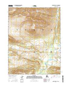
2016 Map of Ambler River A-1 SE
USGS Topo · Published 2016About this map
The Mauneluk River winds through the southeastern reaches of this remote Alaskan wilderness, serving as the primary hydrological feature in an otherwise unpopulated landscape. This 2016 survey provides a clear look at the dramatic transition from high alpine elevations in the north to the lower river basin. The map is defined by its rigorous vertical detail, charting the steep descent of unnamed ridges down toward the meandering watercourse. Managed largely by the Bureau of Land Management, the terrain is divided by the Public Land Survey System grids of t20n r12e, t20n r13e, t19n r12e, and t19n r13e. This documentation captures the area's pristine state, showing no roads, structures, or established settlements, focusing instead on the raw topography of the Northwest Arctic.
Find a feature on this map
5 named features on this map. Tap any name to fly to it.
Don’t see what you’re looking for? This feature index may not catch every label — zoom into the map to look around manually.
Map Details
Editions of this 2016 Ambler River A-1 SE Map
This is the sole edition of this map. No revisions or reprints were ever made.
Other maps of this area

1951 · Shungnak
USGS Topo · 1:250,000

1951 · Hughes
USGS Topo · 1:250,000

1951 · Survey Pass
USGS Topo · 1:250,000

1951 · Ambler River
USGS Topo · 1:250,000

1955 · Shungnak
USGS Topo · 1:250,000

1956 · Hughes
USGS Topo · 1:250,000

1956 · Survey Pass
USGS Topo · 1:250,000

1956 · Ambler River
USGS Topo · 1:250,000

1964 · Survey Pass
USGS Topo · 1:250,000

1964 · Shungnak
USGS Topo · 1:250,000