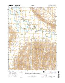
2016 Map of Ambler River C-1 NE
USGS Topo · Published 2016About this map
The Noatak River meanders across this Arctic landscape, cutting through the northern reaches of Gates of the Arctic National Park. The map reveals a land defined by its glacial hydrology, where large water bodies like Lake Matcharak and Lake Isiak sit amidst an intricate network of drainage systems. The survey detail highlights the sharp transition from the river valley floor to the rising topography near Komakuk Cr and the Ipnetiuk River. This 2016 record provides a clear view of the wilderness boundaries within the Northwest Arctic Borough, where no permanent settlements or roads appear on the terrain, emphasizing the untouched character of the Brooks Range interior. It is an essential document for understanding the modern protected boundaries of one of the nation’s most remote national park landscapes.
Find a feature on this map
10 named features on this map. Tap any name to fly to it.
Don’t see what you’re looking for? This feature index may not catch every label — zoom into the map to look around manually.
Map Details
Editions of this 2016 Ambler River C-1 NE Map
This is the sole edition of this map. No revisions or reprints were ever made.
Other maps of this area

1951 · Survey Pass
USGS Topo · 1:250,000

1951 · Ambler River
USGS Topo · 1:250,000

1956 · Survey Pass
USGS Topo · 1:250,000

1956 · Ambler River
USGS Topo · 1:250,000

1964 · Survey Pass
USGS Topo · 1:250,000

1964 · Ambler River
USGS Topo · 1:250,000

1966 · Survey Pass
USGS Topo · 1:250,000
1984 · Survey Pass D-6
USGS Topo · 1:63,360
1990 · Ambler River C-1
USGS Topo · 1:63,360
1990 · Ambler River D-1
USGS Topo · 1:63,360