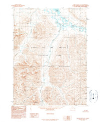
1990 Map of Ambler River C-1
USGS Topo · Published 1990About this map
Gates of the Arctic National Park and the adjacent Gates of the Arctic Wilderness dominate this Arctic landscape, representing a vast expanse of protected roadless terrain in the Brooks Range. The Noatak River serves as a primary drainage system, carving through the northern portion of the quadrangle where it is joined by the waters of Lake Matcharak and Isiak Lake. This 1990 provisional edition, based on aerial photography from the late 1970s and early 1980s, highlights the complex hydrography of the region, including the headwaters of the Ambler River and the meandering paths of Ipnetivik River and Nushralutak Creek. Rising above the river valleys, Blind Pass Mountain stands as a notable landmark for navigation in a territory defined by high-elevation peaks and glacial valleys, untouched by modern road infrastructure.
Find a feature on this map
11 named features on this map. Tap any name to fly to it.
Don’t see what you’re looking for? This feature index may not catch every label — zoom into the map to look around manually.
Map Details
Editions of this 1990 Ambler River C-1 Map
This is the sole edition of this map. No revisions or reprints were ever made.
Other maps of this area

1951 · Survey Pass
USGS Topo · 1:250,000

1951 · Ambler River
USGS Topo · 1:250,000

1956 · Survey Pass
USGS Topo · 1:250,000

1956 · Ambler River
USGS Topo · 1:250,000

1964 · Survey Pass
USGS Topo · 1:250,000

1964 · Ambler River
USGS Topo · 1:250,000

1966 · Survey Pass
USGS Topo · 1:250,000
1984 · Survey Pass D-6
USGS Topo · 1:63,360
1990 · Ambler River D-1
USGS Topo · 1:63,360
1990 · Ambler River B-1
USGS Topo · 1:63,360