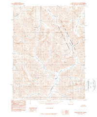
1990 Map of Ambler River B-1
USGS Topo · Published 1990About this map
Gates of the Arctic National Park and the adjacent Gates of the Arctic Wilderness dominate this Arctic landscape in the Brooks Range. This 1990 provisional survey documents a roadless wilderness defined by intricate drainage networks and high-elevation passes. Shishakshinovik Pass serves as a notable landmark amidst the complex topography of the central map area. The hydrology is centered on the southward-flowing Kogoluktuk River, which is joined by numerous tributaries including Kutarlak Creek and the Igning River. To the northwest, the Ipneiliuik River and Utaneak Creek carve through the terrain. This map reflects the state of the Northwest Arctic region a decade after the establishment of the national park, showing a landscape entirely devoid of roads or permanent settlements, where travel remains dictated by river valleys and mountain gaps.
Find a feature on this map
10 named features on this map. Tap any name to fly to it.
Don’t see what you’re looking for? This feature index may not catch every label — zoom into the map to look around manually.
Map Details
Editions of this 1990 Ambler River B-1 Map
This is the sole edition of this map. No revisions or reprints were ever made.
Other maps of this area

1951 · Survey Pass
USGS Topo · 1:250,000

1951 · Ambler River
USGS Topo · 1:250,000

1956 · Survey Pass
USGS Topo · 1:250,000

1956 · Ambler River
USGS Topo · 1:250,000

1964 · Survey Pass
USGS Topo · 1:250,000

1964 · Ambler River
USGS Topo · 1:250,000

1966 · Survey Pass
USGS Topo · 1:250,000
1985 · Ambler River A-2
USGS Topo · 1:63,360
1985 · Ambler River A-1
USGS Topo · 1:63,360
1986 · Survey Pass A-6
USGS Topo · 1:63,360