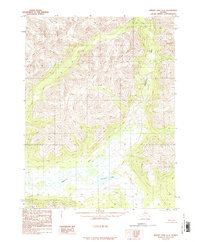
1986 Map of Survey Pass A-6
USGS Topo · Published 1986About this map
Mauneluk River defines the drainage of this interior Alaskan wilderness, as seen in this 1986 provisional survey. The river carves through a landscape of sharp ridges and deep valleys, its path marked by an intricate network of tributary streams. To the south, Avaraart Lake sits within a low-lying basin, surrounded by wetland complexes and smaller unnamed ponds. Compiled from aerial photography taken in 1978, this map provides a detailed view of the natural topography before any significant human development, showing a terrain shaped entirely by water and ice. The absence of roads or permanent structures on this sheet underscores the isolation of the Northwest Arctic region during the late twentieth century.
Find a feature on this map
2 named features on this map. Tap any name to fly to it.
Don’t see what you’re looking for? This feature index may not catch every label — zoom into the map to look around manually.
Map Details
Editions of this 1986 Survey Pass A-6 Map
This is the sole edition of this map. No revisions or reprints were ever made.
Other maps of this area

1951 · Shungnak
USGS Topo · 1:250,000

1951 · Hughes
USGS Topo · 1:250,000

1951 · Survey Pass
USGS Topo · 1:250,000

1951 · Ambler River
USGS Topo · 1:250,000

1955 · Shungnak
USGS Topo · 1:250,000

1956 · Hughes
USGS Topo · 1:250,000

1956 · Survey Pass
USGS Topo · 1:250,000

1956 · Ambler River
USGS Topo · 1:250,000

1964 · Survey Pass
USGS Topo · 1:250,000

1964 · Shungnak
USGS Topo · 1:250,000