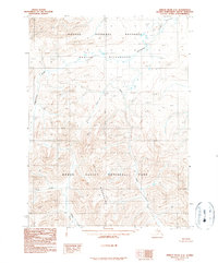
1990 Map of Ambler River C-6
USGS Topo · Published 1990About this map
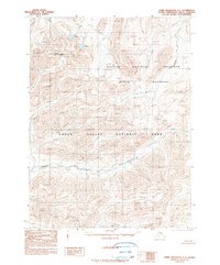
Akiak Mountains dominate the southern half of this landscape, where high-elevation peaks and ridges form the headwaters for several major drainage systems. This 1980 snapshot illustrates a remote arctic wilderness where the boundary of Kobuk Valley National Park meets the Noatak National Preserve and the Noatak Wilderness. The drainage patterns are clearly defined by Hunt River and Natmotirak Creek, which carve deep valleys through the high terrain. In the southern portion, Akiak Creek flows westward, dictated by the steep contours of the surrounding peaks. This map serves as a primary record of the federal land management boundaries established in this part of the Northwest Arctic Borough during the late twentieth century, showing the intersection of the Kateel River and the Principal Meridian.
Find a feature on this map
14 named features on this map. Tap any name to fly to it.
Don’t see what you’re looking for? This feature index may not catch every label — zoom into the map to look around manually.
Map Details
Editions of this 1990 Ambler River C-6 Map
This is the sole edition of this map. No revisions or reprints were ever made.
Other maps of this area

1951 · Baird Mountains
USGS Topo · 1:250,000

1951 · Ambler River
USGS Topo · 1:250,000

1956 · Ambler River
USGS Topo · 1:250,000

1956 · Baird Mountains
USGS Topo · 1:250,000

1964 · Ambler River
USGS Topo · 1:250,000

1965 · Baird Mountains
USGS Topo · 1:250,000
1990 · Ambler River B-5
USGS Topo · 1:63,360
1990 · Ambler River B-6
USGS Topo · 1:63,360
1990 · Ambler River D-6
USGS Topo · 1:63,360
1990 · Baird Mountains C-1
USGS Topo · 1:63,360