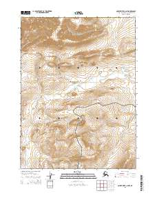
2015 Map of Ambler River C-6 NW
USGS Topo · Published 2015About this map
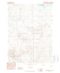
Noatak National Preserve and Kobuk Valley National Park dominate this northern landscape, meeting along a high-relief boundary defined by the Baird Mountains. This 2015 survey reveals the hydrological divide where the southward-flowing Hunt River and Natmotirak Cr carve through high elevation contours. The map is a study in undisturbed arctic wilderness, showing the precise intersection of major federal protected lands within the Northwest Arctic Borough. No roads or permanent settlements appear on this quadrangle, emphasizing the area's role as a critical corridor for natural migration and high-latitude watershed preservation.
Find a feature on this map
10 named features on this map. Tap any name to fly to it.
Don’t see what you’re looking for? This feature index may not catch every label — zoom into the map to look around manually.
Map Details
Editions of this 2015 Ambler River C-6 NW Map
This is the sole edition of this map. No revisions or reprints were ever made.
Other maps of this area

1951 · Baird Mountains
USGS Topo · 1:250,000

1951 · Ambler River
USGS Topo · 1:250,000

1956 · Ambler River
USGS Topo · 1:250,000

1956 · Baird Mountains
USGS Topo · 1:250,000

1964 · Ambler River
USGS Topo · 1:250,000

1965 · Baird Mountains
USGS Topo · 1:250,000
1990 · Ambler River D-6
USGS Topo · 1:63,360
1990 · Baird Mountains C-1
USGS Topo · 1:63,360
1990 · Ambler River C-6
USGS Topo · 1:63,360
1990 · Baird Mountains D-1
USGS Topo · 1:63,360