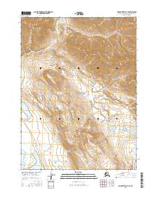
2016 Map of Ambler River D-1 SE
USGS Topo · Published 2016About this map
Gates of the Arctic National Park encompasses the vast majority of this landscape, where the Brooks Range gives way to the drainage basins of the far north. The topographic survey reveals a wilderness defined by its watercourses, most notably the Noatak River as it winds through the southwest corner near Lake Matcharak. The terrain is marked by sharp elevation changes and high mountain peaks, drained by several named streams including Midas Cr in the northern reaches and Niakpukgururuk Cr to the southeast. This 2016 rendering provides a modern baseline for the protected lands within the Northwest Arctic Borough, illustrating a region devoid of permanent settlements or road infrastructure, where the natural hydrography dictate the shape of the land.
Find a feature on this map
11 named features on this map. Tap any name to fly to it.
Don’t see what you’re looking for? This feature index may not catch every label — zoom into the map to look around manually.
Map Details
Editions of this 2016 Ambler River D-1 SE Map
This is the sole edition of this map. No revisions or reprints were ever made.
Other maps of this area

1951 · Survey Pass
USGS Topo · 1:250,000

1951 · Ambler River
USGS Topo · 1:250,000

1956 · Survey Pass
USGS Topo · 1:250,000

1956 · Ambler River
USGS Topo · 1:250,000

1964 · Survey Pass
USGS Topo · 1:250,000

1964 · Ambler River
USGS Topo · 1:250,000

1966 · Survey Pass
USGS Topo · 1:250,000
1984 · Survey Pass D-6
USGS Topo · 1:63,360
1990 · Ambler River C-1
USGS Topo · 1:63,360
1990 · Ambler River D-1
USGS Topo · 1:63,360