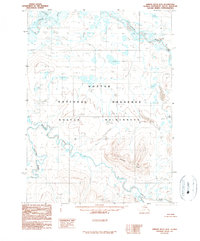
1990 Map of Ambler River D-4
USGS Topo · Published 1990About this map
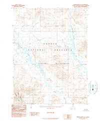
Noatak National Preserve encompasses most of this 1990 provisional study, depicting an Arctic landscape defined by braided river systems and high alpine terrain. The Noatak River meanders across the northern and central sections, joined by tributaries including the Aniuk River and the winding Imelyak River. These waterways reveal a shifting hydrological environment, with numerous small lakes and wet areas scattered across the tundra.
Find a feature on this map
8 named features on this map. Tap any name to fly to it.
Don’t see what you’re looking for? This feature index may not catch every label — zoom into the map to look around manually.
Map Details
Editions of this 1990 Ambler River D-4 Map
This is the sole edition of this map. No revisions or reprints were ever made.
Other maps of this area

1951 · Howard Pass
USGS Topo · 1:250,000

1951 · Ambler River
USGS Topo · 1:250,000

1956 · Howard Pass
USGS Topo · 1:250,000

1956 · Ambler River
USGS Topo · 1:250,000

1964 · Ambler River
USGS Topo · 1:250,000

1984 · Howard Pass A-3
USGS Topo · 1:63,360
1990 · Howard Pass A-4
USGS Topo · 1:63,360
1990 · Ambler River C-5
USGS Topo · 1:63,360
1990 · Ambler River D-5
USGS Topo · 1:63,360
1990 · Ambler River C-4
USGS Topo · 1:63,360