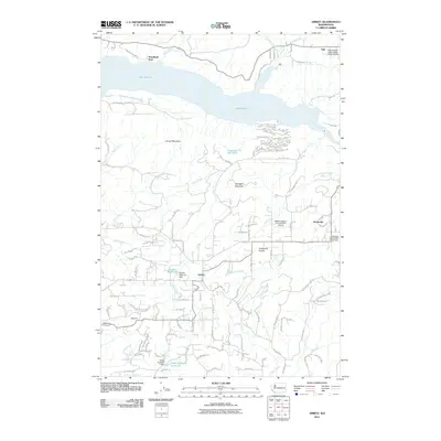
2011 Map of Amboy
USGS Topo · Published 2011About this map
Amboy serves as the central hub of this Clark County landscape, where the foothills meet the varied waterways of the Lewis River system. The northern reach is dominated by the expansive Lake Merwin, created by damming the river, which also feeds into several smaller impoundments like Leroy Anderson Reservoir and Fassett Reservoir. To the east, the Chelatchie Prairie indicates a shift in the local terrain, supporting the small settlement of Chelatchie and its namesake creek.
Find a feature on this map
92 named features on this map. Tap any name to fly to it.
Don’t see what you’re looking for? This feature index may not catch every label — zoom into the map to look around manually.
Map Details
Editions of this 2011 Amboy Map
This is the sole edition of this map. No revisions or reprints were ever made.
Other maps of this area

1919 · Mount St Helens
USGS Topo · 1:125,000

1940 · La Center
USGS Topo · 1:62,500

1941 · Yacolt
USGS Topo · 1:62,500

1943 · Pigeon Springs
USGS Topo · 1:62,500

1948 · Vancouver
USGS Topo · 1:250,000

1950 · Vancouver
USGS Topo · 1:250,000

1950 · Vancouver
USGS Topo · 1:250,000

1953 · Hoquiam
USGS Topo · 1:250,000

1953 · Pigeon Springs
USGS Topo · 1:62,500

1953 · Cougar
USGS Topo · 1:62,500