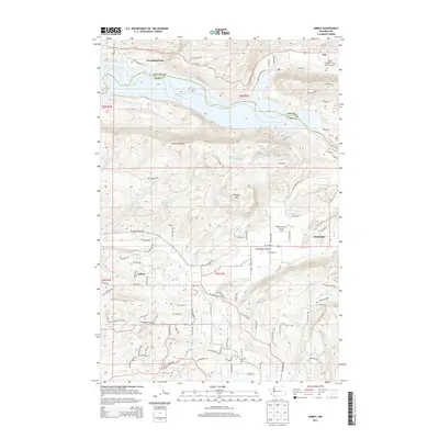
2013 Map of Amboy
USGS Topo · Published 2013About this map
The community of Amboy serves as the focal point for this section of Clark County, where the transition from the Chelatchie Prairie floor to the timbered heights of Green Mountain and Dunegan Mtn is clearly visible. The landscape is defined by its water resources, with Lake Merwin dominating the northern edge along the Cowlitz County border. This 2013 survey illustrates a region where aviation and water management are intertwined with rural life, featuring both the Mount St Helens Aero Ranch Airport and Walter Sutton's Private Strip. Small industrial and agricultural markers remain, such as the Columbia Tie Mill Pond and various reservoirs like Fassett Reservoir and Leroy Anderson Reservoir. The road network, including the NE Fargher Lake Hwy, connects these dispersed settlements and high-altitude terrain.
Find a feature on this map
96 named features on this map. Tap any name to fly to it.
Don’t see what you’re looking for? This feature index may not catch every label — zoom into the map to look around manually.
Map Details
Editions of this 2013 Amboy Map
This is the sole edition of this map. No revisions or reprints were ever made.
Other maps of this area

1919 · Mount St Helens
USGS Topo · 1:125,000

1940 · La Center
USGS Topo · 1:62,500

1941 · Yacolt
USGS Topo · 1:62,500

1943 · Pigeon Springs
USGS Topo · 1:62,500

1948 · Vancouver
USGS Topo · 1:250,000

1950 · Vancouver
USGS Topo · 1:250,000

1950 · Vancouver
USGS Topo · 1:250,000

1953 · Hoquiam
USGS Topo · 1:250,000

1953 · Pigeon Springs
USGS Topo · 1:62,500

1953 · Cougar
USGS Topo · 1:62,500