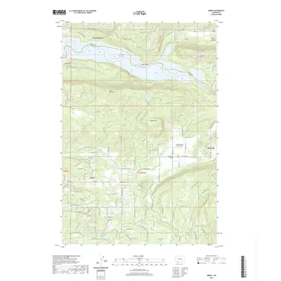
2020 Map of Amboy
USGS Topo · Published 2020About this map
Amboy and Chelatchie anchor this Clark County landscape, where the flatlands of the Chelatchie Prairie meet the rising slopes of Green Mountain and Dunegan Mtn. To the north, the Lewis River Rd corridor follows the southern shore of Lake Merwin, a prominent reservoir created by the damming of the Lewis River along the Cowlitz County line. The map highlights a history of local industry and aviation, featuring the Columbia Tie Mill Pond and private runways such as Walter Sutton's Private Strip and the Mount St Helen's Aero Ranch near Yale. Smaller water systems like Fassett Reservoir and the Leroy Anderson Reservoir are integrated into the rural road network, which includes numerous family-named routes and service roads such as NE Cedar Creek Rd and NE Columbia Tie Rd.
Find a feature on this map
113 named features on this map. Tap any name to fly to it.
Don’t see what you’re looking for? This feature index may not catch every label — zoom into the map to look around manually.
Map Details
Editions of this 2020 Amboy Map
This is the sole edition of this map. No revisions or reprints were ever made.
Other maps of this area

1919 · Mount St Helens
USGS Topo · 1:125,000

1940 · La Center
USGS Topo · 1:62,500

1941 · Yacolt
USGS Topo · 1:62,500

1943 · Pigeon Springs
USGS Topo · 1:62,500

1948 · Vancouver
USGS Topo · 1:250,000

1950 · Vancouver
USGS Topo · 1:250,000

1950 · Vancouver
USGS Topo · 1:250,000

1953 · Hoquiam
USGS Topo · 1:250,000

1953 · Pigeon Springs
USGS Topo · 1:62,500

1953 · Cougar
USGS Topo · 1:62,500