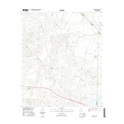
2016 Map of Ambrose
USGS Topo · Published 2016About this map
The Red River forms the northern boundary of this landscape where Grayson and Fannin counties meet the Oklahoma border. The area is defined by a dendritic network of waterways including Choctaw Creek, Sandy Cr, and Corneliason Cr, which carve through the terrain south of the river bluffs. Settlement patterns are tied to both historical transport and modern transit, with the community of Bells situated in the south and the smaller hamlet of Ambrose to the east. Genealogists will find several burial sites noted, such as Cherry Mound Cem, Dugan Cem, and Isom Cem. Evidence of past infrastructure is visible in the Old RR Grade near the river, while the Skida Patch Airport indicates more recent local aviation activity. Larger water bodies like Stern Lake and Valley Lake provide significant landmarks among the agricultural and residential road networks.
Find a feature on this map
92 named features on this map. Tap any name to fly to it.
Don’t see what you’re looking for? This feature index may not catch every label — zoom into the map to look around manually.
Map Details
Editions of this 2016 Ambrose Map
This is the sole edition of this map. No revisions or reprints were ever made.
Other maps of this area

1901 · Denison
USGS Topo · 1:125,000

1954 · Sherman
USGS Topo · 1:250,000

1957 · Denison Dam
USGS Topo · 1:24,000

1958 · Durant
USGS Topo · 1:62,500

1958 · Whitesright
USGS Topo · 1:62,500

1958 · Denison Dam
USGS Topo · 1:62,500

1958 · Sherman
USGS Topo · 1:250,000

1958 · Sherman
USGS Topo · 1:62,500

1958 · Sherman
USGS Topo · 1:24,000

1958 · Howe
USGS Topo · 1:24,000