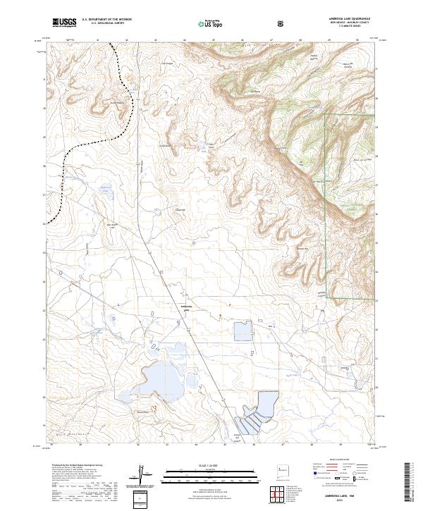
2023 Map of Ambrosia Lake
USGS Topo · Published 2023About this map
Ambrosia Lake sits at the heart of this high-desert basin in McKinley County, defined by a series of prominent mesas and volcanic landmarks. The landscape is structured by vast drainage systems like the Arroyo del Puerto, while human presence is marked by scattered water improvements such as Antonio Tank and Voght Tank. On the eastern edge, the topography rises sharply toward the Cibola National Forest, where the massive profiles of San Mateo Mesa and Mesa de Ortega dominate the horizon. Named landmarks including Don Andres Hill, Julian Hill, and Punta Maestra provide specific reference points for navigating the complex terrain of the San Juan Basin. The inclusion of sites like Laguna del Monte and the spring at Ojo del Hijinio highlights the critical role of water sources in this arid environment.
Find a feature on this map
40 named features on this map. Tap any name to fly to it.
Don’t see what you’re looking for? This feature index may not catch every label — zoom into the map to look around manually.
Map Details
Editions of this 2023 Ambrosia Lake Map
This is the sole edition of this map. No revisions or reprints were ever made.
Other maps of this area

1883 · Mt. Taylor
USGS Topo · 1:250,000

1886 · Mt. Taylor
USGS Topo · 1:250,000

1892 · Mt. Taylor
USGS Topo · 1:250,000

1899 · Mt. Taylor
USGS Topo · 1:250,000

1957 · Ambrosia Lake
USGS Topo · 1:24,000

1957 · Dos Lomas
USGS Topo · 1:24,000

1957 · Bluewater
USGS Topo · 1:24,000

1957 · Goat Mountain
USGS Topo · 1:24,000

1958 · Albuquerque
USGS Topo · 1:250,000

1961 · Piedra De La Aguila
USGS Topo · 1:24,000