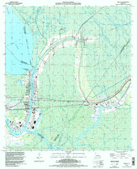
1994 Map of Amelia
USGS Topo · Published 1998About this map
Bayou Boeuf and the Bayou Intracoastal Waterway serve as the industrial arteries of this St. Mary Parish landscape, where the energy economy is deeply etched into the wetlands. This survey, updated with 1994 imagery, shows a dense network of extraction including the Amelia Gas Field, Ramos Gas Field, and Simon Pass Gas Field. Numerous pipelines and tanks flank the settlements of Amelia and Zacarter, illustrating the intersection of residential life and the oil industry in the late 20th century.
Find a feature on this map
44 named features on this map. Tap any name to fly to it.
Don’t see what you’re looking for? This feature index may not catch every label — zoom into the map to look around manually.
Map Details
Editions of this 1994 Amelia Map
This is the sole edition of this map. No revisions or reprints were ever made.
Other maps of this area

1892 · Gibson
USGS Topo · 1:62,500

1892 · Thibodaux
USGS Topo · 1:62,500

1897 · Gibson
USGS Topo · 1:62,500

1932 · Thibodaux SW
USGS Topo · 1:31,680

1935 · Morgan City
USGS Topo · 1:62,500

1938 · Labadieville
USGS Topo · 1:24,000

1939 · Gibson
USGS Topo · 1:62,500
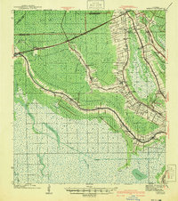
1941 · Gibson
USGS Topo · 1:62,500
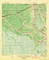
1944 · Gibson
USGS Topo · 1:62,500

1945 · New Orleans
USGS Topo · 1:250,000