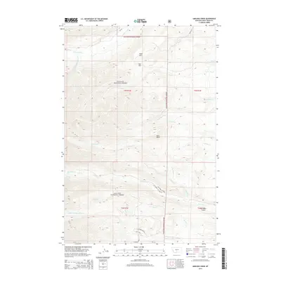
2014 Map of Amelong Creek
USGS Topo · Published 2014About this map
Gallatin National Forest dominates this section of Sweet Grass County, where the high-altitude terrain is defined by steep drainages and prominent peaks. The map detail highlights the hydrological network of the region, specifically where the N Amelong Cr and S Amelong Cr converge into Amelong Creek. This area is a critical access point for the Big Timber Canyon, reached via the Big Timber Canyon Rd. High-elevation landmarks like Raspberry Butte and Black Butte provide orientation points above Wolf Park. For researchers, the inclusion of the Big Timber Cr Admin Site and the Upper Big Timber Falls provides specific points of interest within the forest boundaries, while the presence of Melville Rd indicates the primary routes connecting these mountain landscapes to the nearby plains.
Find a feature on this map
32 named features on this map. Tap any name to fly to it.
Don’t see what you’re looking for? This feature index may not catch every label — zoom into the map to look around manually.
Map Details
Editions of this 2014 Amelong Creek Map
This is the sole edition of this map. No revisions or reprints were ever made.
Other maps of this area

1886 · Little Belt Mts.
USGS Topo · 1:250,000

1891 · Livingston
USGS Topo · 1:250,000

1893 · Livingston
USGS Topo · 1:250,000

1894 · Little Belt Mts.
USGS Topo · 1:250,000

1897 · Little Belt Mts.
USGS Topo · 1:250,000

1898 · Little Belt Mts.
USGS Topo · 1:250,000

1902 · Little Belt Mts.
USGS Topo · 1:250,000

1947 · Bozeman
USGS Topo · 1:250,000

1948 · Bozeman
USGS Topo · 1:250,000

1948 · White Sulphur Springs
USGS Topo · 1:250,000