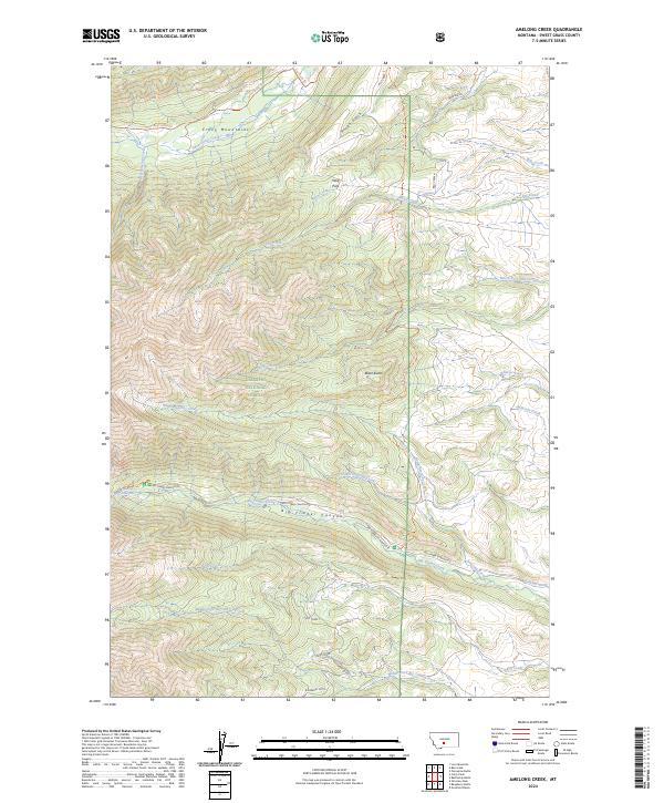
2024 Map of Amelong Creek
USGS Topo · Published 2024About this map
The Gallatin National Forest dominates this section of Sweet Grass County, where the high peaks of the Crazy Mountains transition into a complex network of canyons and gulches. The landscape is defined by the headwaters of numerous drainages, including North Amelong Creek and South Amelong Creek, which converge as they flow eastward out of the high country. Historical land management and access are evident through the Big Timber Cr Admin Site and established routes like the Sweet Grass Trl and East Trunk Trl. A notable example of early water engineering appears as the Stocker Ditch, which follows the contours of the lower slopes. Geological landmarks such as Black Butte and Raspberry Butte provide distinct navigational points above the deep incision of Big Timber Canyon, while the Whiskey Big Timber Falls marks a sharp change in elevation along the area's primary waterway.
Find a feature on this map
38 named features on this map. Tap any name to fly to it.
Don’t see what you’re looking for? This feature index may not catch every label — zoom into the map to look around manually.
Map Details
Editions of this 2024 Amelong Creek Map
This is the sole edition of this map. No revisions or reprints were ever made.
Other maps of this area

1886 · Little Belt Mts.
USGS Topo · 1:250,000

1891 · Livingston
USGS Topo · 1:250,000

1893 · Livingston
USGS Topo · 1:250,000

1894 · Little Belt Mts.
USGS Topo · 1:250,000

1897 · Little Belt Mts.
USGS Topo · 1:250,000

1898 · Little Belt Mts.
USGS Topo · 1:250,000

1902 · Little Belt Mts.
USGS Topo · 1:250,000

1947 · Bozeman
USGS Topo · 1:250,000

1948 · Bozeman
USGS Topo · 1:250,000

1948 · White Sulphur Springs
USGS Topo · 1:250,000